1.1 Spatial evidence across the restoration cycle
1.1.1 What is restoration?
Landscape restoration ultimately aims to improve ecosystem function, the productive capacity of lands and resilience and wellbeing of communities that depend on them.
Healthy ecosystems regulate water, maintain soil fertility, support biodiversity, and sustain agricultural and pastoral production. When these ecological processes function well, they provide the ecosystem services that support resilient livelihoods.
Degradation can therefore be understood as the loss or decline of these ecological functions. For example, declining soil organic carbon, increasing erosion, reduced vegetation cover, or declining water retention capacity can all signal that a landscape is losing its productive potential and the ecosystem services therefrom.
This raises several important questions for restoration practitioners:
- How do we recognise when land is degraded or degrading?
- What ecological processes are driving those changes?
- Which interventions are most likely to restore ecosystem function?
- How can we measure whether restoration efforts are actually working?
Answering these questions requires evidence that links ecological conditions to specific places on the landscape and allows change to be measured over time.
1.1.2 Restoration decisions in practice
In practice, restoration programmes need to translate restoration objectives into practical decisions about where to act, what interventions to use, and how to evaluate results.
Many restoration initiatives therefore move through a sequence of decision stages that link ecological understanding, planning, implementation, and learning.
We might refer to this as the restoration decision cycle.
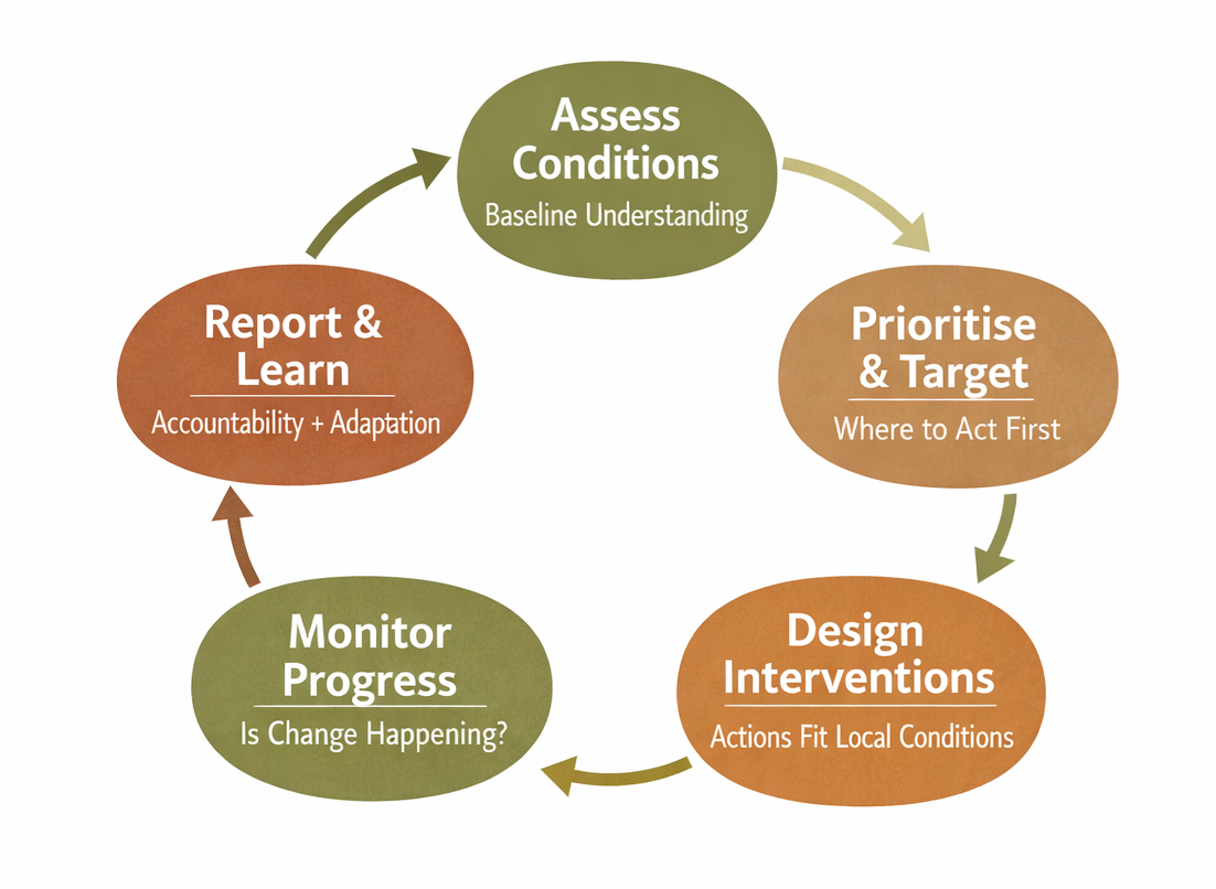
1.1.3 The restoration decision cycle
Landscape assessment establishes a baseline understanding of ecological conditions and trends.
Key questions at this stage include:
- What are the natural characteristics of the landscape (vegetation systems, soils, climate)?
- What ecological processes are changing?
- Where are signs of degradation most evident?
- What are the likely drivers of these changes?
Understanding these conditions helps identify what the landscape's naturally occurring conditions are, where restoration may be needed, and which ecological processes should be protected or restored.
Targeting and prioritisation determine where restoration interventions should be focused.
Key questions at this stage include:
- Where are degradation pressures highest?
- Which ecological functions are most in need of restoration?
- Where are interventions most likely to succeed?
- Where would restoration generate the greatest ecological or livelihood benefits?
Because resources are limited, restoration programmes must decide where to focus efforts in order to achieve the greatest impact.
Intervention design determines which restoration practices are appropriate for specific ecological conditions.
Key questions at this stage include:
- What restoration approaches are suitable for this landscape?
- Are conditions appropriate for planting, natural regeneration, or soil and water conservation?
- Which species are ecologically appropriate for the local climate and soils?
- What risks or constraints might affect intervention success?
Different restoration approaches such as tree planting, farmer-managed natural regeneration (FMNR), or soil and water conservation are suited to different environmental conditions. We need evidence to back our design decisions to ensure feasibility and suitability.
Monitoring examines whether restoration activities are leading to the intended ecological changes.
Key questions at this stage include:
- Are ecological indicators improving in intervention areas?
- Are observed changes consistent with the expected mechanisms of restoration?
- Are improvements occurring where interventions were implemented?
- How are conditions changing through time?
Because restoration outcomes often occur gradually, and sometimes non-linearly, monitoring systems need to detect trends in indicators such as vegetation condition, soil carbon, erosion prevalence, or water availability.
Reporting translates monitoring evidence into clear and credible information for governments, donors, and other stakeholders.
Key questions at this stage include:
- What ecological changes have occurred since restoration activities began?
- Where are improvements most visible and effective?
- How do results compare across projects or regions?
- Do outcomes align with restoration objectives?
Effective reporting should demonstrate not only that activities occurred, but also that ecological conditions improved, and that they are attributable to the intervention.
1.1.4 The evidence gap
Restoration programmes require reliable evidence to understand ecological conditions, design appropriate interventions, and demonstrate whether restoration efforts are producing meaningful outcomes.
Evidence can come from a variety of sources, including:
Field surveys and ecological monitoring
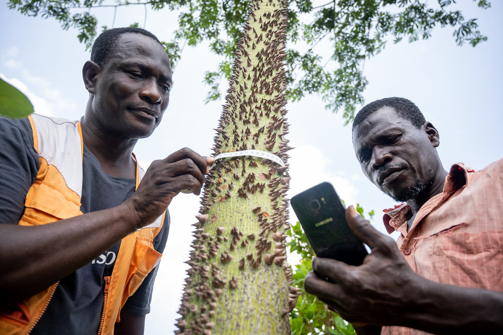
Field measurements of soils, vegetation, biodiversity, and land management practices. In-situ observations are often the most reliable way to understand ecological processes at specific sites, but they tend to be resource-intensive and difficult to scale across large landscapes.
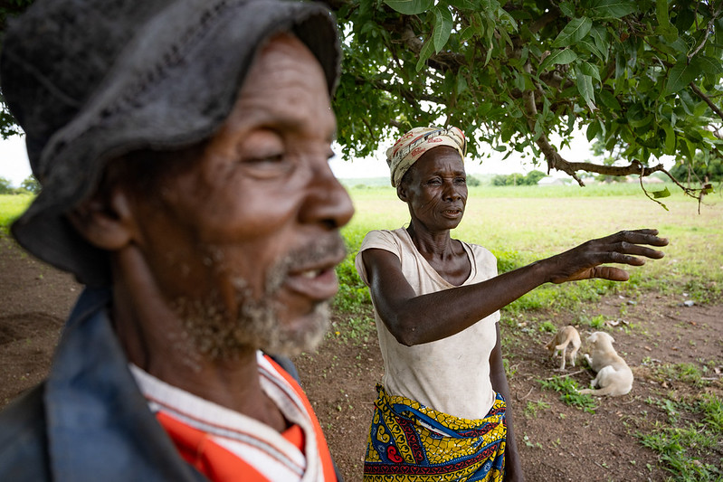
Experience, assumptions, practitioner and local knowledge
Information from previous project learnings, practitioner knowledge, and local knowledge is often used to guide project decisions. Certain decisions may rely on assumptions from other projects or other sources which may not always be reliable.
Proxy indicators and simplified metrics
Some monitoring systems rely on simplified indicators such as vegetation cover, tree planting counts, or other easily measurable metrics as signals of restoration progress.
While it is important to draw on many lines of evidence when making restoration decisions, from detailed project-level data to traditional ecological knowledge and proxy indicators, the limitations of each of these should be considered.
This is especially true in the context of large-scale or multi-country restoration programmes, where there is a need for comparable, consistent data.
For example, field surveys provide detailed information about specific sites, but they are often difficult to scale across large landscapes, and may not be representative of broader conditions. Local knowledge can provide valuable insights into ecological processes and restoration potential, but it may not always be transferable across different contexts. Proxy indicators such as vegetation cover or tree planting counts can be useful for tracking certain aspects of restoration progress, but they may not fully capture the underlying ecological functions that restoration aims to improve.
Different sources of evidence can provide valuable insights, but they often face common constraints when restoration programmes operate across large landscapes.
- Collecting ecological data consistently across large regions can be difficult and resource-intensive.
- Monitoring frameworks often differ between projects or organisations, making results hard to compare.
- Tracking ecological change over time requires consistent indicators and long-term monitoring systems.
- Aggregating results across districts, countries, or programmes can be challenging when datasets are fragmented.
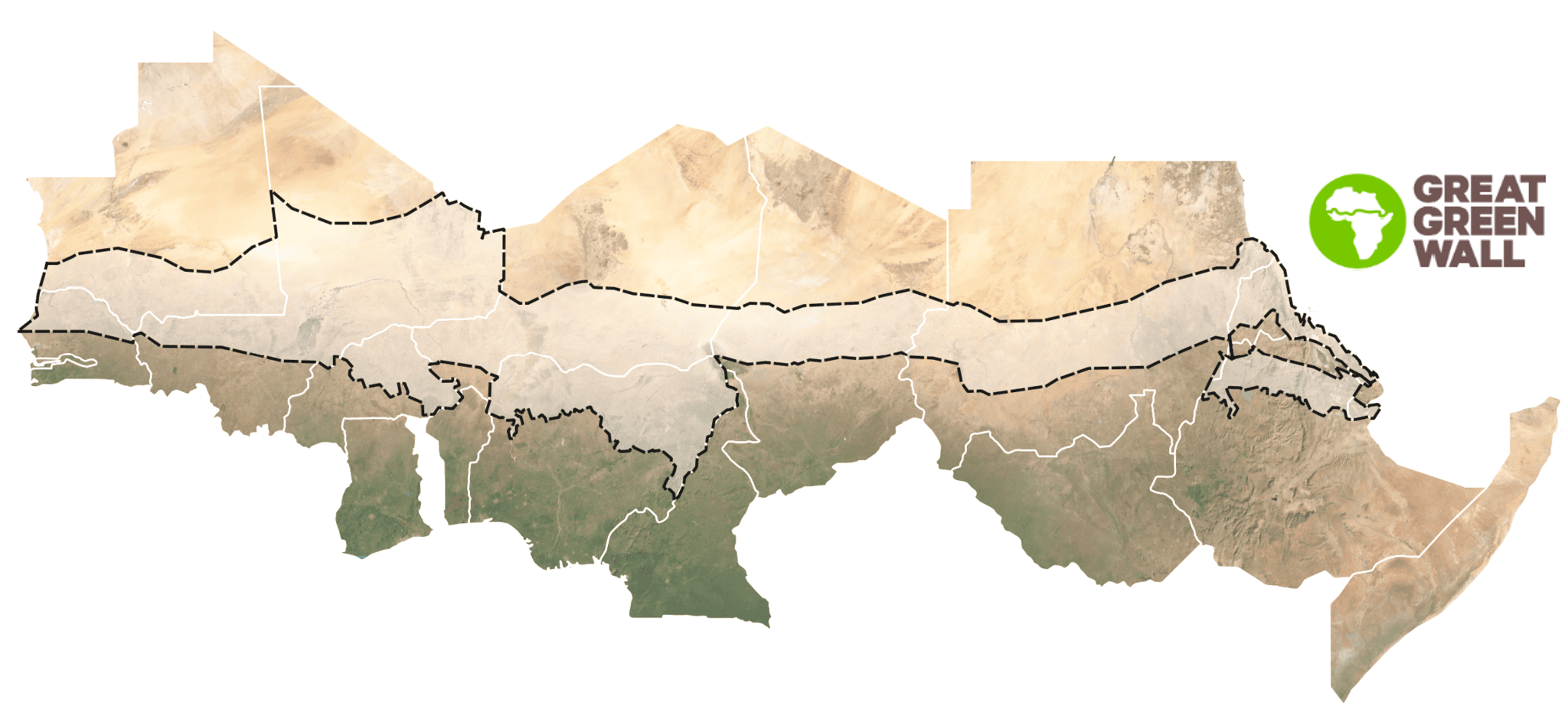
These challenges are particularly relevant for large initiatives such as the Great Green Wall, where restoration activities span multiple countries and institutions and progress must often be reported against regional or global frameworks.
When evidence systems are inconsistent or fragmented, it becomes difficult to verify results, compare progress across regions, or build a shared understanding of which restoration approaches are most effective.
1.1.5 The role of spatial evidence
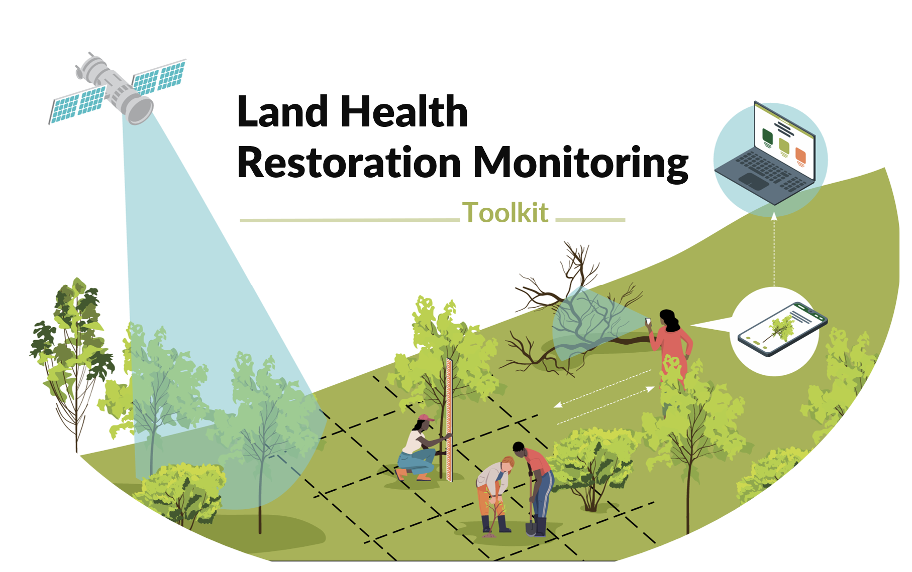
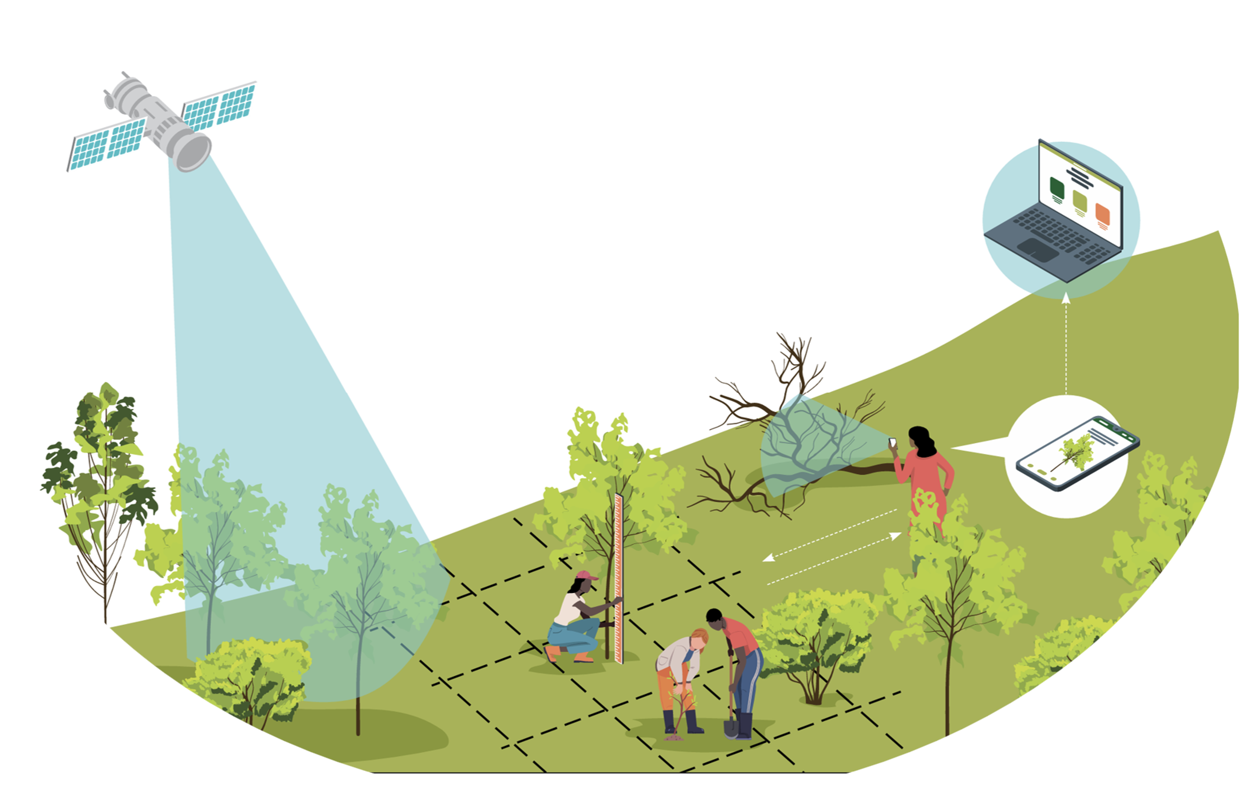
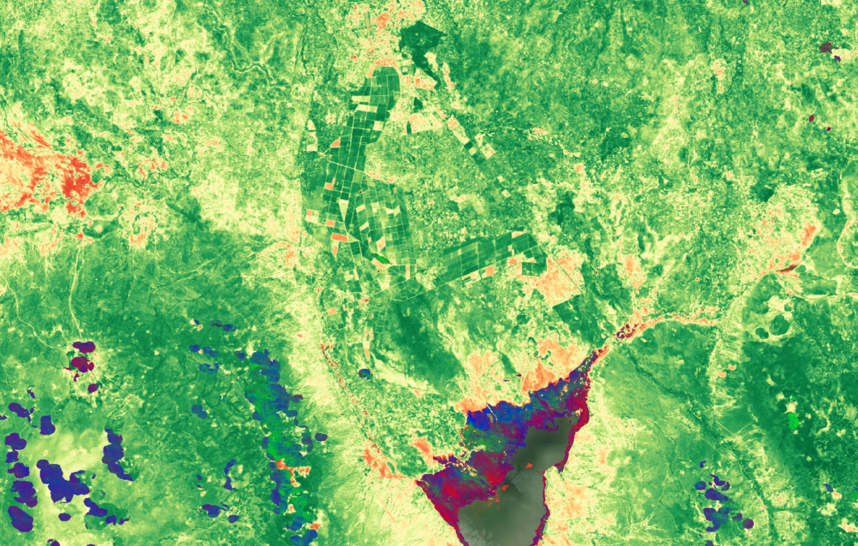
Science-based spatial evidence helps address some of these challenges by providing consistent, scalable indicators of ecological conditions across landscapes.
Satellite datasets combined with data collected from systematic field surveys, and predictive spatial modeling allow indicators such as vegetation condition, soil carbon, rainfall variability, or erosion risk to be analysed across entire regions rather than only at individual field sites.
When generated using consistent methods, these datasets allow ecological indicators to be:
- Mapped across large landscapes
- Compared between regions and projects
- Tracked through time using the same metrics
- Quantifiable and transparent
Spatial evidence like predictive maps of ecological indicators are a powerful complement to field observations and local knowledge, helping restoration programmes generate evidence that is comparable, transparent, and scalable.
The next section explains what we mean by spatial evidence and data, and why these tools have become increasingly important for restoration planning, monitoring, and reporting.